Maps and Globes for Class 4
Maps and globes are part of our everyday lives. They help us know our world in a better way. With the help of Maps and Globes we can go anywhere — to the top of the tallest mountain on earth or the bottom of the deepest ocean. In a small space Maps and Globes show us many things such as continents, countries, mountains, rivers, etc. Yet there are some differences in the way Maps and Globes are used in our daily lives.
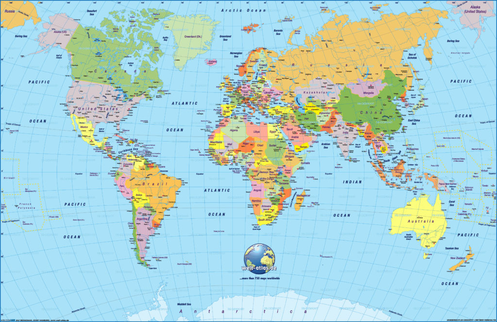
What is a Map?
A Map is a drawing of all or part of Earth’s surface such as a country, city, rivers and lakes, forests, buildings, and roads on a flat surface, like a sheet of paper.
Types of Maps?
There are different types of maps that people uses for different purposes. Each type of map serves a different purpose, but they all show the Earth in their own way. Some people use maps to find their way around new places. Some people use maps for educational purposes. Professionals like scholars, scientist, researchers use different maps for their work. Some different types of maps are given below.
Political Map: A political map shows the political boundaries of countries, states, cities, towns and villages. An example of a political map is a map of India with all the states and union territories outlined.
Physical Map: A physical map is one which shows the physical features of a place or country, like rivers, sea, lakes, mountains, forests and lakes.
Climate Map: A climatic map shows the information about the climate of different areas. It shows whether an area is generally hot, cold, wet or dry.
Road Map: Road map is the most widely used map which shows important roads, highways or railways present in a particular area. It is a very detailed map and is generally used for direction purposes.
Apart from above maps, there many other maps such as Economic or Resource Maps, Population Density Maps, etc.
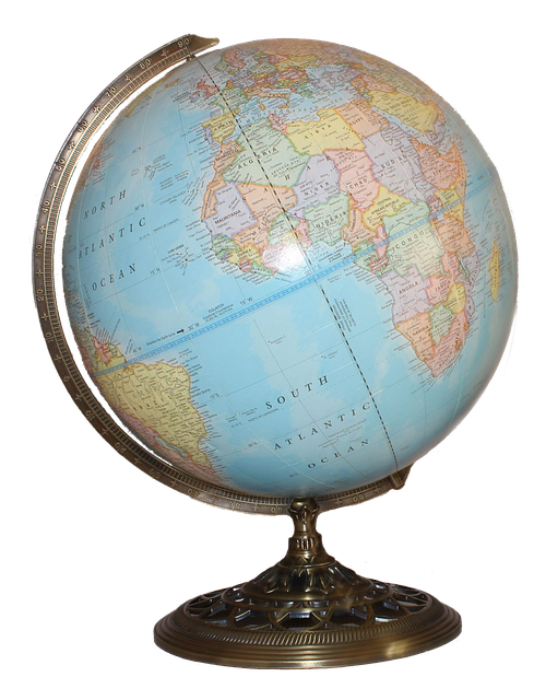
What is a Globe?
A globe is a small spherical model of Earth. The most common types of globes are political and physical. Political globes show countries. Physical globes shows landscape like mountains and rivers.
Difference between Globe and Map?
| Globe | Map |
|---|---|
| 1. Globes are round. | 1. Maps are flat. |
| 2. Globes shows the whole earth. | 2. Maps shows whole or a part of the earth. |
| 3. As globe shows the whole earth in a small space, it cannot show large amount of information. | 3. Maps can be used to show only a small part of the earth to give large amount of information. |
| 4. Globes are three dimensional. | 4. Maps are two dimensional. |
| 5. Globes are difficult to carry. | 5. Maps are easier to carry. |
A. ANSWER THESE QUESTIONS.
- Define map?
- Define globe?
- List the difference between maps and globes?
- Why are symbols used on a map?
- What is the legend of a map?
B. TRUE OR FALSE.
- A globe always shows the whole earth.
- Two cities 1,000 km apart are shown 10 cm apart on a map. The scale of the map is 1 cm to 100 km.
- Roads are usually shown as blue lines on a map.
- Natural resources are shown in political maps.
- Maps in an atlas show more detail than a globe.
- On a map, plains and lowlands are usually shown in green.
- The scale of a map is shown by the compass rose.
- Globe shows the true shapes of the continents and oceans.
- The scale helps us find the real distance between two places on the map.
- Most maps are drawn with the south at the top.
C. FILL IN THE BLANKS.
- 1 cm on a map is equal to 100 km on the ground. If two cities on the map are 5 cm apart, the real distance between them is ______ km.
- If directions are not marked on a map, the south is towards the _________ of the map.
- States and capital cities are shown on a __________ map.
- The colour blue is used to show _________ in physical maps.
- A compass rose shows the _______ on a map.
- To find our way around a city we use a ________ map.
- A ______ may or may not show the whole world.
- ________ maps use different colours to show different countries or states.
- A ______ always shows the whole world.
- Globes are ________, maps are _________.
If you like this chapter – Maps and Globes for Class 4, please share it among your friends on WhatsApp and Facebook.
[addthis tool=”addthis_relatedposts_inline”]
Must Read: Muhavare in Hindi for Class 4